
24th July 2021
Monsoon has been eccentric this year. Nobody predicted that monsoon can exhibit such uncanny behaviour. Its raining buckets in Western ghats while puny in coastal areas. Some of stations at foothills of Western Ghats recorded massive 1200mm in matter of 4 days while the coastal areas hardly saw cumulative of 50mm rain in same period. The usual pattern is that monsoon starts beating coastal areas, later advances to Ghats and later pulls back to coast before lessening its intensity. This year it came up its own pattern. Eventually, the coastal Karnataka is still deprived of rains. The deficit has touched to -35% and its widening with lull monsoon activity.
With monsoonal flows slowing down, Sun is slowly extending its presence over Bangalore city nowadays. The breeze has reduced and we have extended sunlight over Bangalore. Consequently, the weather was ideal to have yet another drive to bucolic world. The location we chose was Nelligudde lake near Bidadi. Our plan was to visit during evening hours and enjoy the sunset with natural landscapes. We started at 2PM from Hebbal and maps showed a different route which can directly take us to kengeri town and thus bypassing all the mayhem of city. As usual, the goregotunapalya signal was flooded with vehicles which slowed down our drive for a while. Barring little hurdles, the journey later was smooth all the way till Kengeri. Multiple construction works are underway along mysore road including metro and national highway extension. Being mid-day the vehicular traffic was minimal which allowed us to drive smoothly. However half baked work slowed down our journey despite the feeble traffic. The real challenge appeared when map was constantly asking us to take right deviation which was either closed or vanished due to digging. It looks like map is unaware of the construction work. It tried us to navigate along deviations which are either closed or did not exist. Finally after rummaging for U-turn, we finally caught one. The map later asked us to take a village route which would lead us to the lake.
The drive for 5kms was smooth. It was fascinating to watch the hills and sun peeping out of clouds. At times the village homes closely attached to main roads which we thought would be dead-end but soon you realize that there is more to go. The problematic part was junction past 5kms of interior drive. The maps showed right deviation and guided us in village mud path. This path was dead-end. We returned and couple more dead-paths were shown by maps. Then we submitted to villagers and they guided properly. The junction where we steered the car towards right should have been left. A few kms of drive, we reached the lake comfortably and mesmerising nature healed our stress instantly.


The lake is quite expansive. The water seems to be used for purpose of fishing and cultivation. I am not sure if it serves the drinking water need. A muddy promenade stretching for 400mts allows you to walk over and enjoy the glimpses of lake thoroughly.

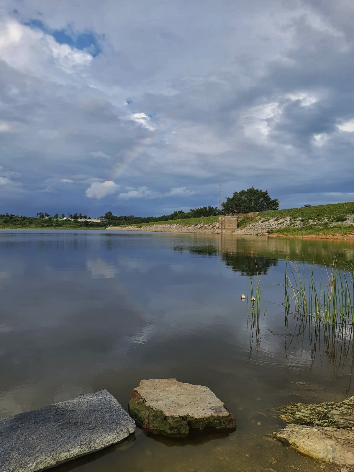


We spent more than hour relaxing in nature enjoying rain shafts, rainbow and sunset. Plenty of birds were also chirping nearby. I spotted plain prinia after long time. Brahminy kite and little egrets were busy catching dinner of the day. It is possible to walk near the lake bed and enjoy in water. Since this spot is not officially developed as tourist destination, no facilities is to be expected. So be careful while taking a dip in water.


Like Dandiganahalli Dam, a short concrete bridge is constructed at the middle which allows you to enjoy the panoramic view of lake. This allows you to experience the expansiveness of the lake. The bridge is also not appalling like the one in Dandiganahalli Dam.


The other attraction is the road running parallel to lake. Not everyone would find it interesting but an avid landscape photographer would see it as photographic perspective. Standing at the edge of lake (perhaps east direction) promenade with clean road on one side and shining lake from other side makes a perfect match for photography during golden hours.

We relaxed near the lake shore for a while before concluding the visit. Faint rainbow too added to our joy. There is unique about these rainbow when they appear amidst natural landscape.

The return journey 2kms before Kengeri was pathetic. It took nearly 2 hrs to drive from Kengeri to Hebbal with jams at frequent locations. The lethargic Bangalore-Mysore highway work, multiple digging for metro work and surprise rains fuelled the traffic jams which were clearing at snail's pace. The body was filled with fatigue as we reached home. Overall eventful day with large part of it spent in traffic unfortunately :-(.
How to reach:
Maps misguides you sometimes. Once you catch the interior roads, take help of locals to reach the destination. Also many of the deviations along Mysore road as shown by maps is closed or non-existent due to ongoing highway upgrade work. Look for subsequent U-turns to get back on track.
There are no food joints nearby but plenty along Mysore road. If you are a bird nerd, make sure to carry telephoto lens to capture those action packed hunts of aquatic birds and raptors.
A short video to end the blog

Scenic views.
ReplyDelete...taking picture of water is a favorite of mine too. These are wonderful.
ReplyDeleteGreetings and Salutations! What kind of vehicle is that in second to last photograph? Usage? I enjoyed the cyber tour of these scenic views. Nice job on the beautiful photographs! Same here. Summer is welcome to construction zones and lots of vehicles on the roads to and from quiet areas you want to visit.
ReplyDeleteGorgeous captures!
ReplyDeleteBeautiful skies! There has been a lot written about how GPS maps can be extremely dangerous, even deadly. It the desert, they can and sometimes do direct you onto roads that are not passable. People get stuck, which can be deadly.
ReplyDelete